The ancient world was far more sophisticated than many imagine, especially when it comes to measuring land, constructing monuments, and navigating vast territories. Long before modern technology, civilizations developed ingenious surveying instruments that allowed them to build pyramids, aqueducts, and entire cities with remarkable precision.
These tools weren’t just practical devices—they represented humanity’s quest to understand space, geometry, and the movement of celestial bodies. From the simple yet elegant gnomon to complex dioptra mechanisms, ancient surveying instruments reveal a legacy of mathematical brilliance that continues to influence modern science and engineering.
🌍 The Gnomon: Ancient Astronomy’s Simple Marvel
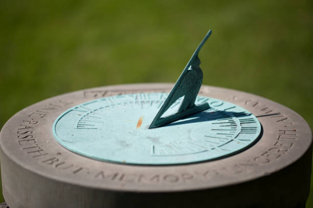
The gnomon stands as one of humanity’s earliest scientific instruments, consisting simply of a vertical stick or pillar that casts a shadow. Despite its simplicity, this device unlocked profound insights into astronomy, timekeeping, and geography that shaped ancient civilizations.
Ancient Egyptians used gnomons extensively to track the sun’s movement and establish accurate timekeeping systems. By observing shadow lengths throughout the day, they could divide daylight into measurable units. The shadow’s shortest length indicated local noon, providing a reliable reference point for daily activities and religious ceremonies.
Greek mathematicians elevated the gnomon to new heights of scientific application. Eratosthenes famously used gnomon observations from two different cities to calculate Earth’s circumference around 240 BCE, achieving remarkable accuracy without leaving the ancient world. His method compared shadow angles at Alexandria and Syene during the summer solstice, demonstrating the power of simple instruments combined with brilliant reasoning.
Gnomon Applications Across Civilizations
Chinese astronomers developed sophisticated gnomon techniques during the Zhou Dynasty, creating elaborate systems to track seasonal changes and celestial movements. Their observations helped establish agricultural calendars that governed planting and harvesting cycles across the empire.
In India, gnomons called “shanku” played crucial roles in astronomical observatories. The Jantar Mantar complexes built by Maharaja Jai Singh II in the 18th century featured massive gnomon structures reaching heights of nearly 90 feet, demonstrating how ancient principles continued influencing architectural design centuries later.
📐 The Groma: Rome’s Engineering Companion
Roman surveyors, known as agrimensores, relied heavily on an instrument called the groma for laying out straight lines and right angles. This device consisted of a vertical staff with a horizontal cross mounted on top, from which hung four weighted plumb lines at 90-degree intervals.
The groma enabled Roman engineers to establish the characteristic grid patterns visible in Roman military camps, cities, and road networks throughout the empire. Its precision allowed surveyors to create the famous Roman roads that connected distant provinces with remarkably straight paths across varied terrain.
Archaeological discoveries have revealed actual groma remains at Pompeii, providing tangible evidence of Roman surveying practices. These findings show that Romans understood the importance of standardized instruments for maintaining consistency across their vast engineering projects.
Roman Surveying Techniques
Roman surveyors combined the groma with other tools like the chorobates, a long leveling instrument equipped with water channels or plumb lines to establish horizontal planes. This combination allowed them to construct aqueducts with gradients so precise that water flowed consistently across miles of channels, sometimes spanning valleys on massive arcade structures.
The decumanus and cardo system used in Roman city planning demonstrated systematic application of groma measurements. These perpendicular main streets formed the organizational spine of Roman settlements, with property divisions radiating outward in organized blocks called insulae.
🔭 The Dioptra: Ancient Precision Engineering
The dioptra represented one of the most sophisticated surveying instruments of antiquity, combining features of modern theodolites with water leveling mechanisms. Invented by Greek engineers, this device could measure both horizontal and vertical angles with impressive accuracy.
Heron of Alexandria wrote extensively about the dioptra in his treatises, describing its construction and various applications. The instrument featured a sighting tube mounted on a calibrated circular base, allowing surveyors to measure angles in multiple planes. A water-filled trough attached to the base provided leveling capabilities.
Engineers used the dioptra for calculating distances to inaccessible points, determining heights of structures, and planning tunnel excavations. The famous Eupalinian aqueduct on Samos, a tunnel over 1,000 meters long dug from both ends simultaneously around 530 BCE, likely employed dioptra-like instruments to achieve its remarkable meeting accuracy.
Advanced Dioptra Applications
Beyond basic surveying, ancient engineers adapted the dioptra for astronomical observations and mapmaking. The instrument could track celestial positions when mounted on stable platforms, contributing to early star catalogs and understanding of planetary movements.
Military applications of the dioptra included range finding and siege warfare planning. Engineers could calculate distances to enemy fortifications and determine optimal positions for siege engines, giving tactical advantages during campaigns.
⚖️ The Chorobates: Mastering Level Surfaces
The chorobates served as ancient Rome’s premier leveling instrument, essential for projects requiring precise horizontal alignment. This device typically measured about 20 feet long and featured a channel that could be filled with water to establish perfectly level surfaces.
Vitruvius described the chorobates in his architectural treatise “De architectura,” explaining its construction with vertical plumb lines positioned at each end. Surveyors could cross-reference the water level with plumb line positions to ensure accuracy even in windy conditions that might disturb the water surface.
Roman aqueduct construction depended heavily on chorobates measurements. Engineers needed to maintain consistent gradients, typically dropping only a few centimeters per kilometer, to ensure steady water flow without excessive speed that could damage channels. The aqueducts supplying Rome with water from sources over 50 miles away testified to the chorobates’ effectiveness.
🧭 Ancient Surveying in Egypt: Building the Impossible
Egyptian surveyors, called “harpedonaptai” or rope-stretchers, developed remarkable techniques for creating precise measurements using simple tools. Their primary instrument was the merkhet, a palm rib with a plumb line used together with a sighting tool to establish straight lines and determine cardinal directions.
The construction of pyramids required unprecedented surveying accuracy. The Great Pyramid of Giza demonstrates orientation to cardinal directions accurate to within fractions of a degree, achieved without magnetic compasses or modern instruments. Egyptians likely used stellar observations combined with merkhet sightings to establish these precise alignments.
Egyptian Measurement Standards
The royal cubit served as Egypt’s standard measurement unit, equal to approximately 52.4 centimeters. Surveyors used calibrated cubit rods marked with subdivisions for precise measurements. Archaeological evidence shows these rods were remarkably standardized across the kingdom, ensuring consistency in construction projects.
Rope stretching techniques allowed Egyptian surveyors to create right angles using the 3-4-5 triangle principle. By marking a rope at intervals of 3, 4, and 5 units and stretching it into a triangle, they could reliably establish perfect 90-degree angles for building foundations.
🗺️ Surveying Innovations from Ancient China
Chinese civilization developed independent surveying traditions with unique instruments and methods. The gnomon reached sophisticated applications in China, with bronze gnomons featuring calibrated scales for precise shadow measurements used in astronomical observatories.
The “south-pointing chariot,” while primarily a navigational device, demonstrated Chinese understanding of direction maintenance useful for surveying expeditions. This mechanical device maintained a consistent directional reference through differential gearing, functioning without magnetic properties.
Chinese Cartography and Land Measurement
During the Han Dynasty, Chinese surveyors developed systematic approaches to mapping that incorporated mathematical principles. Zhang Heng, a polymath of the 2nd century CE, created detailed maps using grid systems and scale measurements, establishing cartographic traditions that influenced Asian mapmaking for centuries.
The “counting rods” used in Chinese mathematics facilitated complex calculations needed for surveying work. These rods allowed surveyors to perform arithmetic operations in the field, calculating areas, distances, and volumes without written materials.
🏛️ Islamic Golden Age Contributions to Surveying
Medieval Islamic scholars preserved and expanded ancient surveying knowledge, developing new instruments and refining existing techniques. The astrolabe, while primarily an astronomical tool, served surveying purposes by measuring angles and determining latitudes.
Islamic engineers created elaborate water distribution systems requiring precise surveying. The qanat systems of Persia, underground aqueducts stretching for miles, demanded accurate gradient calculations and alignment techniques that showcased advanced engineering capabilities.
Astronomical Instruments in Surveying
Large astronomical instruments built during the Islamic Golden Age, such as mural quadrants and armillary spheres, incorporated surveying principles. These devices measured celestial positions with unprecedented accuracy, advancing both astronomy and mathematical geography.
Al-Biruni, an 11th-century Persian scholar, developed methods for calculating Earth’s radius using mountain heights and angular observations. His techniques refined earlier Greek approaches, demonstrating how surveying principles connected terrestrial and celestial measurements.
🔨 Materials and Construction of Ancient Instruments
Ancient surveying instruments required skilled craftsmanship using available materials. Bronze served as the preferred metal for precision components due to its durability and workability. Greek and Roman instrument makers achieved remarkable manufacturing accuracy given their technological limitations.
Wooden components featured in larger instruments like the chorobates, with craftsmen selecting stable woods that resisted warping. Metal fittings reinforced stress points, combining materials to optimize performance and longevity.
Preservation and Archaeological Discoveries
Few ancient surveying instruments survive intact, making archaeological discoveries particularly valuable for understanding historical techniques. The Pompeii groma remains one of the best-preserved examples, offering insights into Roman surveying practices frozen in time by volcanic eruption.
Museum collections worldwide house fragments and reconstructions of ancient instruments. The Museum of Ancient Inventions at various universities has created working replicas based on textual descriptions and archaeological evidence, allowing researchers to test ancient surveying techniques practically.
📚 Legacy and Modern Connections
Ancient surveying principles underpin modern geodesy, cartography, and civil engineering. The fundamental concepts of triangulation, leveling, and angular measurement refined by ancient civilizations remain relevant despite technological advances.
Modern surveyors use electronic theodolites and GPS systems, but these tools ultimately perform the same basic functions as ancient instruments—measuring angles, distances, and elevations to map terrain and guide construction. Understanding historical surveying provides context for appreciating how measurement science evolved.
Educational Value of Historical Instruments
Studying ancient surveying instruments offers valuable lessons about problem-solving with limited resources. Ancient engineers achieved remarkable results through careful observation, mathematical reasoning, and ingenious tool design, demonstrating that innovation thrives under constraints.
Many educational programs incorporate historical surveying experiments, allowing students to use replica instruments and experience ancient measurement techniques firsthand. These activities build appreciation for mathematical principles and historical scientific achievements while teaching practical skills.
🌟 Rediscovering Ancient Wisdom
Modern researchers continue uncovering new insights about ancient surveying through experimental archaeology and textual analysis. Recent studies have replicated Egyptian pyramid construction techniques, demonstrating that historical methods could indeed achieve the precision observed in surviving monuments.
Digital modeling allows scholars to test hypotheses about ancient instrument capabilities and surveying procedures. These simulations reveal that ancient engineers possessed sophisticated understanding of geometry and optics, often developing solutions remarkably similar to modern approaches.
The fascination with ancient surveying extends beyond academic circles, capturing public imagination through documentaries, museum exhibitions, and educational programs. This interest reflects broader appreciation for ancient technological achievements and recognition that historical civilizations possessed impressive scientific capabilities.
As we develop increasingly advanced surveying technologies, examining ancient instruments reminds us that human ingenuity transcends particular tools or time periods. The same curiosity and determination that drove ancient surveyors to map their worlds continues inspiring modern scientists and engineers to push measurement accuracy to new frontiers, maintaining an unbroken chain of innovation spanning millennia.